



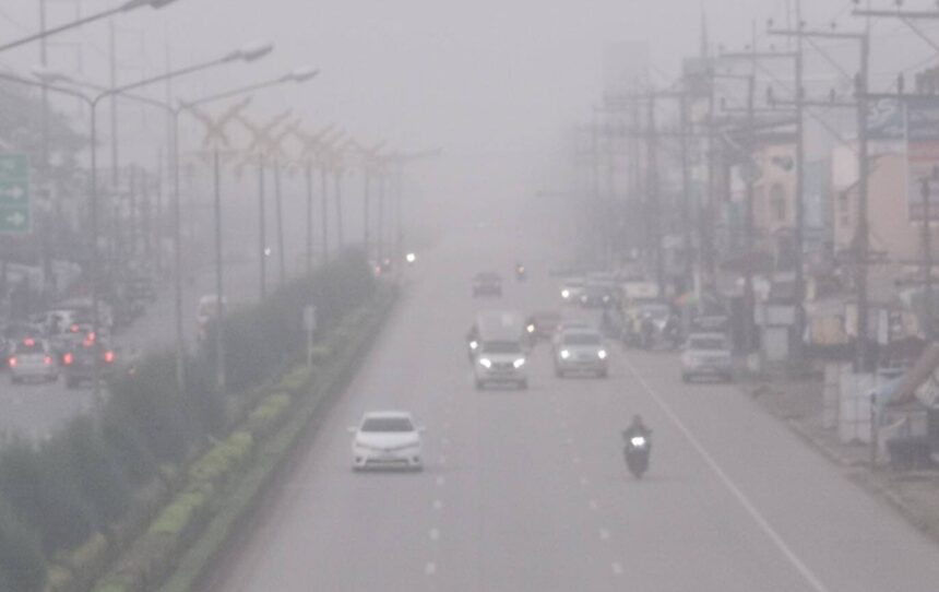
CHIANG RAI— Drivers across northern Thailand face dense morning fog through Tuesday before a moderate cold wave drops temperatures starting Nov. 18, the Thai Meteorological Department announced Saturday.
Forecasters expect lingering rain to clear out of Chiang Rai, Chiang Mai and Mae Hong Son over the weekend, creating crisp mornings from Nov. 14 to Nov. 17. A stronger surge of cool air will follow from Nov. 18 to Nov. 26, even as heavy downpours continue to batter southern provinces.
Key Takeaways
- Northern provinces expect cool, foggy mornings from Nov. 14 to Nov. 17 as rain tapers off in Chiang Mai, Chiang Rai and Mae Hong Son.
- A moderate cold wave will move across upper Thailand from Nov. 18 to Nov. 26, bringing sharper temperature drops to mountain peaks.
- Heavy rain persists across southern Thailand, while expats driving northern mountain routes face low visibility during early morning hours.
Regional Weather Split Across Thailand
The weather shift marks a sharp divide between Thailand’s upper valleys and its southern coastline. According to the TMD seasonal outlook, rainfall is steadily retreating from the upper North, leaving behind dry afternoons and chilly nights. Valley floors in Chiang Mai and Chiang Rai will dip to between 16 and 20 degrees Celsius, while high-altitude peaks like Doi Inthanon and Phu Chi Fa could approach single digits.
Southern Thailand faces the opposite extreme. A prevailing northeast monsoon continues to push moisture over the Gulf of Thailand and the Andaman Sea, triggering heavy rain across southern provinces from Chumphon down to Narathiwat. Coastal officials have warned small boats to stay ashore and urged residents in low-lying areas to watch for flash floods.
Why High Pressure Drives the November Shift
This rapid transition stems from a recurring atmospheric tug-of-war each November. Meteorologists officially declared the start of Thailand’s cool season on Nov. 9 after a wet October delayed the seasonal shift. As a high-pressure system from China expands southward, dry continental air collides with residual ground moisture left behind by late-season rains.
When clear night skies allow heat to escape quickly from northern river basins, trapped humidity condenses into thick ground fog before dawn. In mountainous terrain like Mae Hong Son, cold air drains down steep slopes into narrow valleys, creating sudden whiteout pockets along winding highways. Once the stronger cold air mass arrives on Nov. 18, brisk northeasterly winds will scour out much of the lingering moisture, replacing damp fog with crisp, dry chill.
Weekend Outlook and Fog Safety for Hill Drivers
For expats and weekend travelers heading onto northern routes—including Highway 1095 to Pai or the steep switchbacks near Chiang Rai’s mountain viewpoints—this weekend brings pleasant daytime sunshine after tricky early mornings. Visibility will drop sharply between 5 a.m. and 8:30 a.m., especially near river crossings and shaded ridge passes.
Road safety experts advise motorists to slow down well before entering mist banks and avoid sudden braking on damp asphalt. Keep headlights on low beam rather than high beam, which reflects off water droplets and blinds oncoming traffic. Use fog lights if equipped, leave extra following distance behind slow-moving trucks, and delay dawn departures until after 9 a.m. when morning sun burns off the thickest valley haze.