
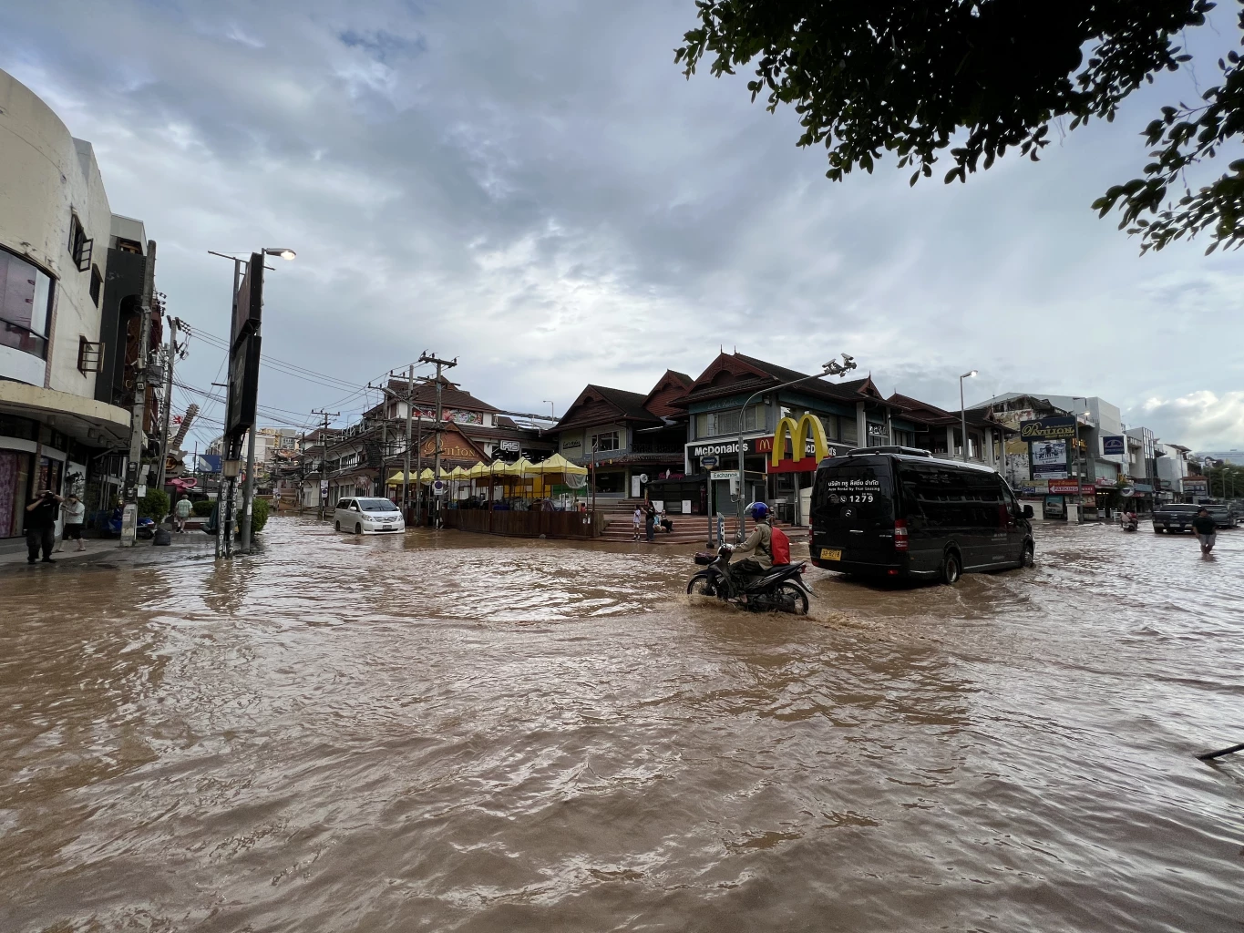
Flooding worsened in the centre of Northern Thailand’s Chiang Mai City on Monday as the overflowing Ping River rose amid relentless rain.
The Ping River’s water level rose further on Monday afternoon, threatening to exacerbate the flooding that has already flooded downtown, Chiang Mai.
Chiang Mai’s provincial disaster prevention and mitigation office reported the level at Nawarat Bridge at 4 p.m. was 4.65 m, 0.95 m over its safe level and higher than the 4.52 m observed on Monday morning.
“The water level continues to increase,” according to the office.

Chiang Mai Flood Map
Since the Ping River burst its banks, some sections in Muang district were badly flooded, and rain continued to fall on the city on Monday. According to the municipality administration, the heaviest flooding occurred in tambon Pa-dad in Chiang Mai city. The Charoen Prathet road, the night bazaar, Chang Klan road, and the road to Lamphun were all submerged.
The flooding around Chiang Mai railway station caused safety worries regarding the lines, and officials opted to move passengers booked on two special express trains to Bangkok by bus to board trains at stations south of the city.
Charan Yiemwej, a weather forecaster at the Meteorological Department in Bangkok, said heavy rain would continue till Tuesday in Chiang Mai and other provinces bordering Myanmar and the lower part of the northern area.
After a several-hour break, heavy rain returned to Chiang Mai at 7 p.m. on Monday before ceasing.
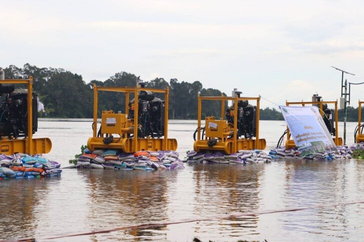
Pumping Stations Added in Chiang Mai
Earlier, the Ping River burst its banks on Sunday night, inundating over 1,000 houses in the city. On Monday morning, the water continued, and local people were instructed to transfer their things to higher ground.
Even though sandbags were built along the Ping River’s banks, water sprung up from sewers in Muang district’s municipal territory.
When the water level approached 5 meters, the scene resembled the severe flooding of 2011. As water from streams upstream continued to flood into the Ping, local officials feared a similar disaster.
The river gets its water from the Mae Taeng and Mae Rim rivers.
Water was up to a metre deep in some portions of Muang district, forcing inhabitants to flee. Due to flooding, several schools and government offices were closed on Monday.
They were mostly on Chang Khlan and Charoen Prathet roads, although they were also in Pa Phrao Nok and Nong Hoi.
Rain fell steadily in Chiang Dao, Mae Taeng, Mae Rim, Mae Ai, Fang, San Sai, and Doi Saket districts of Chiang Mai, all of which are upstream of the city.


