


CHIANG RAI – The Thai Meteorological Department (TMD) has issued a severe weather alert for northern and Northeastern Thailand due to Tropical Storm Kajiki, which intensified from a tropical depression in the upper South China Sea.
The storm is expected to bring heavy to very heavy rainfall and strong winds across northern and upper northeastern Thailand from August 25–27, 2025. Kajiki is forecast to make landfall in northern Vietnam and upper Laos on August 25–26, weakening into a tropical storm and later a depression as it moves toward Thailand’s Nan province by August 26.
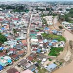
Affected northern provinces include Nan, Chiang Rai, Phayao, Chiang Mai, Mae Hong Son, Lamphun, Lampang, Phrae, and Uttaradit, with Nan at high risk of flash floods and landslides, potentially receiving up to 200mm of rain.
Residents are urged to prepare for severe weather, flash floods, landslides, and transport disruptions, particularly in low-lying and mountainous areas.
Weather 25 August 2025
- Northern region: Chiang Rai, Lamphun, Lampang, Phayao, Nan, Phrae, Uttaradit, Phichit, Phitsanulok, and Phetchabun
- Northeast: Loei, Nong Khai, Bueng Kan, Nong Bua Lamphu, Udon Thani, Sakon Nakhon, Nakhon Phanom, Mukdahan, Nakhon Ratchasima, and Ubon Ratchathani
- Central: Kanchanaburi, Ratchaburi, Samut Songkhram, Samut Sakhon, Nakhon Pathom, Bangkok and neighbouring areas
- East: Nakhon Nayok, Prachin Buri, Sa Kaeo, Chanthaburi, and Trat
- South: Phetchaburi, Prachuap Khiri Khan, Chumphon, Ranong, Phang Nga, Phuket, and Krabi
Weather 26-27 August 2025
- Northern region: Mae Hong Son, Chiang Mai, Chiang Rai, Lamphun, Lampang, Phayao, Nan, Phrae, Uttaradit, Sukhothai, Tak, Kamphaeng Phet, Phichit, Phitsanulok, and Phetchabun
- Northeast: Loei, Nong Khai, Bueng Kan, Udon Thani, Sakon Nakhon, Nakhon Phanom, Khon Kaen, Kalasin, Mukdahan, Yasothon, Amnat Charoen, and Ubon Ratchathani
- Central: Nakhon Sawan, Uthai Thani, Chai Nat, Kanchanaburi, Ratchaburi, Bangkok and surrounding provinces
- East: Nakhon Nayok, Prachin Buri, Sa Kaeo, Chachoengsao, Chonburi, Rayong, Chanthaburi, and Trat
- South: Phetchaburi, Prachuap Khiri Khan, Chumphon, Ranong, Phang Nga, and Phuket
Waves in the upper Andaman Sea and Gulf of Thailand will be strong, around 2 to 3 metres high, with heights above 3 metres in stormy areas. Boats should take extra care, and small boats should stay in port.
Stay up-to-date with the latest announcements from the Meteorological Department on their website at http://www.tmd.go.th or call 0-2399-4012-13 and 1182, available 24 hours.