


CHIANG RAI – Residents living along the Sai River in Mae Sai say they’re still anxious about severe flooding in 2026. Many feel the demolition of buildings that obstruct the waterway is moving too slowly and could miss the next wet season.
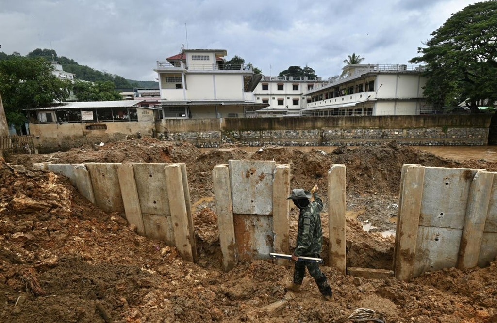
At the same time, the Department of Public Works and Town and Country Planning is preparing a long-term flood solution worth almost 3 billion baht, including relocation plans, drainage upgrades, and a two-layer concrete floodwall system, with construction set to begin on the inner line first.
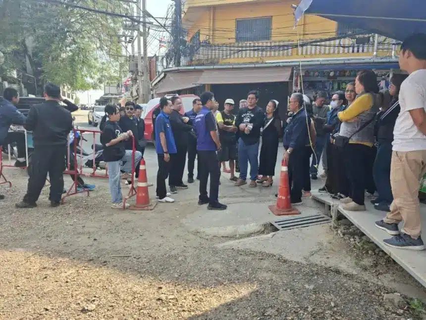
In recent days, Mae Sai District Chief Warayut Khombun assigned the senior district officer and local teams to meet residents from several riverside communities. These include Sai Lom Joy, Hua Fai, Mai Lung Khon, and Koh Sai, among others.
The goal is to explain the government-backed plan to tackle repeated Sai River overflows that flood border communities. The study and design work has been assigned to the Department of Public Works and Town and Country Planning.
Officials told residents that demolition work is planned for 2026, starting with buildings on the eastern side of the first Sai River bridge. Some related steps were already carried out in 2025 and 2026, using a budget of 36 million baht.

Temporary flood barriers
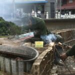
On flood protection, officials said the Army Corps of Engineers previously built temporary and semi-permanent barriers as an urgent measure. Local authorities will also collect community feedback so a permanent system can be built later by the Department of Public Works and Town and Country Planning.
Even with these plans, some residents along the Sai River say they still fear a major flood during the 2026 rainy season. Their main concern is the slow removal of buildings that narrow the river channel, which could leave water with nowhere to go.
People are also uneasy about the proposed two-layer floodwall. They were told construction would start on the inner wall first. Locals argue that if flooding hits while work is ongoing, the area could still be overwhelmed.
They want the outer wall built first and built as a permanent structure, then the inner wall and other parts can follow. Residents have placed signs around the area to show their concerns, and district officials have taken the matter to pass on to relevant agencies.
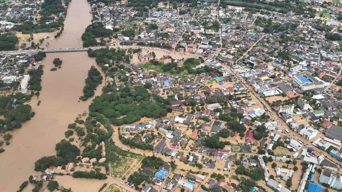

Severe Flooding in 2024
The Sai River overflowed badly from September to October 2024, flooding Mae Sai and nearby areas across the border in Myanmar. The damage hit key economic zones hard. After that, the Army Engineers and the Third Army Area dredged parts of the Ruak River at the end of the Sai River and installed temporary and semi-permanent flood defences along the route.
The government has now allocated a 2025 to 2026 budget of 23,578,000 baht for the Department of Public Works and Town and Country Planning to study a permanent fix.
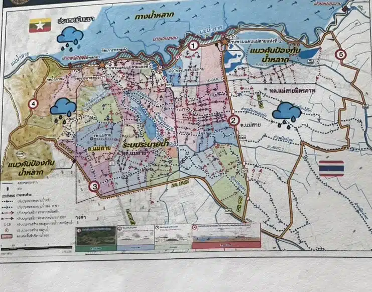
The study covers parts of Wiang Phang Kham Municipality, Mae Sai Municipality, and Mae Sai Mittraphap Municipality. The total area is 56.13 square kilometres.
The concept includes designated floodways, flood embankments, and improved drainage. The system is expected to handle floodwater flowing past the Mueang Daeng weir near Wat Tham Pha Chom at no less than 430 cubic metres per second, matching the peak flow recorded in 2024.

Mae Sai Land Relocation Plan
The plan also includes land to support relocation for people affected by the project. Three initial sites have been identified:
- Plot 1, at the Wiang Phan tobacco station, 78 rai 1 ngan 72 square wah, about 2.5 kilometres from the border
- Plot 2, Ministry of Finance land, about 1,000 rai, about 7.5 kilometres from the border
- Plot 3, state land, 35 rai, about 1.5 kilometres from the border
Riverbank Embankments, Roads, and Demolition Lengths
The Sai River embankment is divided into three sections:
- Section 1, 998 metres
- Section 2, 1,361 metres
- Section 3, 1,561 metres
The plan includes removing buildings and structures along a 485-metre stretch. It also covers road works, including:
- A new road alignment, 631 metres
- Koh Sai Road, 769 metres
- Royal Irrigation Department road, 2,035 metres
Survey and design are scheduled from late 2025 to mid-2026, taking around six months. After that, the proposal will go to the Cabinet. Land acquisition through negotiated purchase is planned for 2026 to 2027, taking about 15 to 18 months, with a central budget of 600 million baht.
Construction Timeline and Overall Budget
Early 2027 is set as the start for the first phase of earth embankments and reinforced concrete embankments, running to late 2028. This phase is expected to take 12 to 18 months and use a budget of 140 million baht.
The remaining reinforced concrete embankments and road construction, plus upgrades to existing roads, are planned from late 2027 to mid-2030. This stage is expected to take 24 to 35 months, with a budget of 160 million baht.
Land acquisition through reconciliation procedures and issuing a royal decree for expropriation is planned from early 2028 to the end of 2029, taking 12 to 24 months, with a budget of 400 million baht.
Riverbank protection works and floodway landscaping are scheduled from mid-2029 to mid-2032, taking 30 to 36 months, with a budget of 400 million baht. Major drainage improvements are planned from mid-2028 through to the end of the project in 2032, taking 42 to 48 months, with a budget of 450 million baht. The overall budget is estimated at 2.95 billion baht.